Updated: 11.02.2024
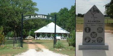 ALAMEDA - located 10 miles south of Ranger on FM 571.
This cemetery has some of the oldest graves in Eastland
County dating back to the 1860s. The Veterans' Memorial
Monument installed on Aug. 26, 2009. Website with names
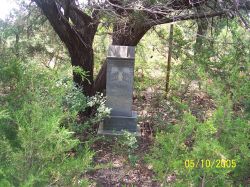 AMES - located south of Ranger near the airport off I-20.
ARTHER GRAVE - located 1 1/2 miles northeast of Desdemona
in a pasture.
BOLLINGER OR FREEDOM - located 3 miles south of the Lake
Leon Bridge.
 BULLOCK - located about 3 1/2 miles north of Ranger on Hwy. 717.
Find A Grave-Website
CENTER POINT - located south from Carbon, on Texas Ranch Rd
1027 about 3 miles, turn left on CR-413 (dirt road) & follow
it for about 3 miles. The cemetery is on the right off the
road just a ways and has a large sign over the gate.
COLONY - located at the North-West corner of Hwy 101 and County
Rd. #339 about five miles from Ranger. The land was given by
Ben L. Denley about 1908. Find A Grave-Website
COOK - located 8 miles south of Ranger off FM 571.
CORINTH - located off CR-154, east of Cisco.
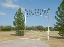 CROSS ROADS - located about six miles south of Ranger on FM 571.
Website with names
DABNEY FAMILY - located one mile northwest of Desdemona off FM-570.
DAVIDSON OR TANNER - located on a CR east of Hwy. 16
and north of Desdemona.
DESDEMONA - located one mile south of Desdemona off Hwy. 16.
DOTHAN CEMETERY - located on CR-126 in Eastland County near Cisco.
ELLISON'S SPRINGS - located east of Gorman off Hwy. 8.
ELM OR MIDWAY - located eight miles southwest of Gorman.
EVANS FAMILY - remote area between FM-571 and Hwy. 16.
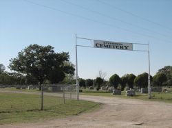 EVERGREEN (Ranger City Cemetery) - located in the city of Ranger,
northwest. Find-A-Grave-Website
FLATWOOD - located east of Hwy 6 on CR 309 in the Flatwood Community.
GORMAN & OAKLAWN - located in the city of Gorman.
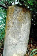 GREGG FAMILY - located on FM 570 north of Desdemona on a farm. The
abandoned Gregg cemetery, like many similar cemeteries needs a group
to care for it by an occasional clearing.
HOWARD - north from Desdemona on Hwy. 16, one & 7/10 miles on dirt
road.
KOKOMO - located by the side of FM-2689 in Kokomo.
MACEDONIA - located in Stephens County on FM-717 about 10 miles
from Ranger.
MANGUM FAMILY - located north of Kokomo off FM 2689.
McGOUGH - located on Finis Johnson farm, 1 1/2 miles NE of Flatwood
Cemetery.
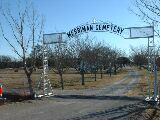 MERRIMAN - located west of Ranger about 2 miles off I-20.
The Merriman Cemetery Association meets once a year usually in May.
Find A Grave-Website
According to local tradition this site was established as a community
graveyard about 1873, the year Eastland County was organized and one year
prior to the community of Merriman's selection as county seat. Although
there are many unmarked gravestones in the cemetery, the earliest recorded
gravestone is that of Orthosias Scarborough (d.1879). The first legal
record of the Merriman Cemetery occurred in a deed executed by the Taylor
Charcoal Company conveying two acres for use as a public burial ground to
trustee M. V. Brewer in 1891.
Oil discovered in 1917 on land owned by John H. McCleskey (buried here in
1918) started an oil boom that ultimately threatened the sanctity of the
Merriman Cemetery. Oil speculators reportedly offered members of the
Merriman Baptist church a large sum of money to lease the cemetery grounds
for drilling. The congregation, although its association with the cemetery
is uncertain, turned the offer down. Josie Fox Duncan (d.1940) deed 75
acres to trustees of the cemetery in 1938 to provide an income for its
perpetual care. The cemetery contains graves of early settlers, veterans
of conflicts from the Civil War to Korea, and victims of a 1916-17
influenza epidemic. Merriman Cemetery Vandalized in 2014
MITCHELL - located off CR-142, SW of Cisco.
MOSS CURVE - located off IH-20 about 3 miles out of Ranger toward
Eastland.
MURRAY - located in Carbon.
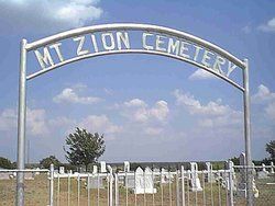 MT. ZION (Veale) - located about 10 miles north of Ranger on a hill
above the intersections of the Caddo and Strawn highways in Stephens
County. It is said that Ezekiel Jackson McCleskey (1860-1926) gave
the land for the cemetery. The oldest grave in the cemetery appears
to be that of M.M. McCluskey who died in 1879.
NECESSITY - located NW of Ranger off Highway 207 going to Breckenridge
in Stephens County. Find A Grave-Website
PILGRIM FAMILY - located on FM-570 between Desdemona & Ranger on farm.
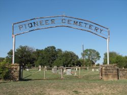 PIONEER (Ranger City Cemetery) - located in the city of Ranger, off
Hwy 80. Website with pictures of grave markers
PLEASANT GROVE CEMETERY - located east of Morton Valley; about a
mile south of Hwy. 101 on the Country Road that is east of Hwy. 1852 with
less than 100 graves.
PROVIDENCE - a small pioneer cemetery located at Lake Leon. When
the lake filled, the cemetery became isolated and can only be reached
by boat now. Last burial was around 1920s. Next to it was the
Providence Baptist Church (organized in the late 1860s and 2nd in
Eastland County) burned years ago.
REDEEMER LUTHERAN CEMETERY - located on Hwy. 183 between
Cisco & Rising Star.
ROMNEY CEMETERY - located 10 miles south of Cisco off Hwy. 183 going
to Rising Star.
RUSSELL CREEK OR LEMLEY - located east of Ranger off I-20 near Russell
Creek.
SCRANTON - located near Cisco on the border of Eastland County at FM-1864
& CR-147.
SIMPSON - located in the Kokomo Community.
STAFF - located near the Staff Community at Lake Leon.
TRACY OR BREWER - located in a pasture east of FM 2461, south of
Merriman.
TUDOR OR GOURDNECK - located 11 miles east of Ranger off I-20.
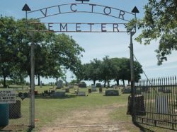 VICTOR - located near Desdemona in the once community of Victor. The
cemetery is all that remains but a meeting is still held every year
in May. C.C. Blair is buried here. He was one of the first settlers
in Eastland County constructing a family fort at now Desdemona for
protection against the Indians. Find A Grave-Website
WAYLAND - located on FM-1852 near Ranger in Stephen County. The
cemetery is behind the Wayland Community (old school) building.
ALAMEDA - located 10 miles south of Ranger on FM 571. This cemetery has some of the oldest graves in Eastland County dating back to the 1860s. The Veterans' Memorial Monument installed on Aug. 26, 2009. Website with names
AMES - located south of Ranger near the airport off I-20. ARTHER GRAVE - located 1 1/2 miles northeast of Desdemona in a pasture. BOLLINGER OR FREEDOM - located 3 miles south of the Lake Leon Bridge.
BULLOCK - located about 3 1/2 miles north of Ranger on Hwy. 717. Find A Grave-Website CENTER POINT - located south from Carbon, on Texas Ranch Rd 1027 about 3 miles, turn left on CR-413 (dirt road) & follow it for about 3 miles. The cemetery is on the right off the road just a ways and has a large sign over the gate. COLONY - located at the North-West corner of Hwy 101 and County Rd. #339 about five miles from Ranger. The land was given by Ben L. Denley about 1908. Find A Grave-Website COOK - located 8 miles south of Ranger off FM 571. CORINTH - located off CR-154, east of Cisco.
CROSS ROADS - located about six miles south of Ranger on FM 571. Website with names DABNEY FAMILY - located one mile northwest of Desdemona off FM-570. DAVIDSON OR TANNER - located on a CR east of Hwy. 16 and north of Desdemona. DESDEMONA - located one mile south of Desdemona off Hwy. 16. DOTHAN CEMETERY - located on CR-126 in Eastland County near Cisco. ELLISON'S SPRINGS - located east of Gorman off Hwy. 8. ELM OR MIDWAY - located eight miles southwest of Gorman. EVANS FAMILY - remote area between FM-571 and Hwy. 16.
EVERGREEN (Ranger City Cemetery) - located in the city of Ranger, northwest. Find-A-Grave-Website FLATWOOD - located east of Hwy 6 on CR 309 in the Flatwood Community. GORMAN & OAKLAWN - located in the city of Gorman.
GREGG FAMILY - located on FM 570 north of Desdemona on a farm. The abandoned Gregg cemetery, like many similar cemeteries needs a group to care for it by an occasional clearing. HOWARD - north from Desdemona on Hwy. 16, one & 7/10 miles on dirt road. KOKOMO - located by the side of FM-2689 in Kokomo. MACEDONIA - located in Stephens County on FM-717 about 10 miles from Ranger. MANGUM FAMILY - located north of Kokomo off FM 2689. McGOUGH - located on Finis Johnson farm, 1 1/2 miles NE of Flatwood Cemetery.
MERRIMAN - located west of Ranger about 2 miles off I-20. The Merriman Cemetery Association meets once a year usually in May. Find A Grave-Website According to local tradition this site was established as a community graveyard about 1873, the year Eastland County was organized and one year prior to the community of Merriman's selection as county seat. Although there are many unmarked gravestones in the cemetery, the earliest recorded gravestone is that of Orthosias Scarborough (d.1879). The first legal record of the Merriman Cemetery occurred in a deed executed by the Taylor Charcoal Company conveying two acres for use as a public burial ground to trustee M. V. Brewer in 1891. Oil discovered in 1917 on land owned by John H. McCleskey (buried here in 1918) started an oil boom that ultimately threatened the sanctity of the Merriman Cemetery. Oil speculators reportedly offered members of the Merriman Baptist church a large sum of money to lease the cemetery grounds for drilling. The congregation, although its association with the cemetery is uncertain, turned the offer down. Josie Fox Duncan (d.1940) deed 75 acres to trustees of the cemetery in 1938 to provide an income for its perpetual care. The cemetery contains graves of early settlers, veterans of conflicts from the Civil War to Korea, and victims of a 1916-17 influenza epidemic. Merriman Cemetery Vandalized in 2014 MITCHELL - located off CR-142, SW of Cisco. MOSS CURVE - located off IH-20 about 3 miles out of Ranger toward Eastland. MURRAY - located in Carbon.
MT. ZION (Veale) - located about 10 miles north of Ranger on a hill above the intersections of the Caddo and Strawn highways in Stephens County. It is said that Ezekiel Jackson McCleskey (1860-1926) gave the land for the cemetery. The oldest grave in the cemetery appears to be that of M.M. McCluskey who died in 1879. NECESSITY - located NW of Ranger off Highway 207 going to Breckenridge in Stephens County. Find A Grave-Website PILGRIM FAMILY - located on FM-570 between Desdemona & Ranger on farm.
PIONEER (Ranger City Cemetery) - located in the city of Ranger, off Hwy 80. Website with pictures of grave markers PLEASANT GROVE CEMETERY - located east of Morton Valley; about a mile south of Hwy. 101 on the Country Road that is east of Hwy. 1852 with less than 100 graves. PROVIDENCE - a small pioneer cemetery located at Lake Leon. When the lake filled, the cemetery became isolated and can only be reached by boat now. Last burial was around 1920s. Next to it was the Providence Baptist Church (organized in the late 1860s and 2nd in Eastland County) burned years ago. REDEEMER LUTHERAN CEMETERY - located on Hwy. 183 between Cisco & Rising Star. ROMNEY CEMETERY - located 10 miles south of Cisco off Hwy. 183 going to Rising Star. RUSSELL CREEK OR LEMLEY - located east of Ranger off I-20 near Russell Creek. SCRANTON - located near Cisco on the border of Eastland County at FM-1864 & CR-147. SIMPSON - located in the Kokomo Community. STAFF - located near the Staff Community at Lake Leon. TRACY OR BREWER - located in a pasture east of FM 2461, south of Merriman. TUDOR OR GOURDNECK - located 11 miles east of Ranger off I-20.
VICTOR - located near Desdemona in the once community of Victor. The cemetery is all that remains but a meeting is still held every year in May. C.C. Blair is buried here. He was one of the first settlers in Eastland County constructing a family fort at now Desdemona for protection against the Indians. Find A Grave-Website WAYLAND - located on FM-1852 near Ranger in Stephen County. The cemetery is behind the Wayland Community (old school) building.